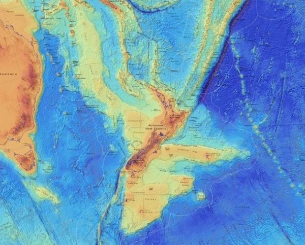
Earth’s mysterious eighth continent doesn’t appear on most conventional maps; that’s because almost 95% of its land mass is submerged thousands of feet beneath the Pacific Ocean.
Zealandia — or Te Riu-a-Māui, as it’s referred to in the indigenous Māori language — is a 2 million-square-mile (5 million square kilometers) continent east of Australia, beneath modern-day New Zealand. Scientists discovered the sprawling underwater mass in the 1990s, then gave it formal continent status in 2017. Still, the “lost continent” remains largely unknown and poorly studied due to its Atlantean geography.
Now, GNS Science — a geohazards research and consultancy organization owned by the government of New Zealand — hopes to raise Zealandia (in public awareness, at least) with a suite of new maps and interactive tools that capture the lost continent in unprecedented detail.


